Working with Point Clouds - Procedure
- Creation of the point cloud on site
In the first step, the point cloud is created on site by scanning the corresponding object with a 3-D laser scanner from different positions.
- Registration of the scans (special software)
The generated scans must then be registered with special software. This software is not part of HiCAD!
- Cropping of the point cloud and export to .E57 file
For designing in HiCAD often only a part of the point cloud is of importance. Therefore, it can be useful to cut away parts of the point cloud that are not needed with the scanner software. Then the point cloud must be exported in the file format .E57.
- Conversion of the .E57 file into the HiCAD format (.lsproj)
The .E57 file must now be converted into the point cloud format (.LSPROJ) readable by HiCAD. HiCAD Point Cloud contains a corresponding Converter for this purpose, which can be started
- directly in HiCAD,
- outside HiCAD or
- via command line call (Command Prompt).
After conversion, the point cloud is available in the .LSPROJ format and can then be used in HiCAD
Editing in HiCAD
- Import the point cloud into an existing HiCAD model drawings
The point cloud in .lsproj format can be inserted into an existing HiCAD drawing as part of the type Point cloud using the corresponding import function.
- Alignment in World CS
Depending on the position in the drawing, the point cloud must still be aligned in the world coordinate system, e.g. by rotation, displacement or similar.
- Define clipping boxes
Since point clouds are usually very large, they can only be used sensibly if so-called clipping boxes are defined for the different areas of a point cloud. By defining a clipping box, unneeded parts of the point cloud can be temporarily cut away so that the remaining area of the point cloud can be better measured or edited. For example, only the back wall or the floor of a building can be displayed and edited.
- Measuring and retracing
Now the point cloud can be measured or a CAD model of the point cloud can be created by retracing the geometry in sketches. The normal HiCAD functions can be used for this purpose. Like other 3-D parts, the point cloud itself can be transformed, referenced and managed in HELiOS. Point clouds are visualised simultaneously with the CAD geometry and can be hidden if required.
- Saving the construction with the point cloud
When saving constructions with point clouds, please note that the point cloud data is not saved in the SZA or KRA file, but only a reference to the corresponding point cloud. Please note the information in thet Save/Manage Point Clouds topic.
|
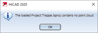
Faro© SCENE projects can also be imported directly into HiCAD, i.e. a conversion via the .E57 format is not necessary. However, it must be ensured that the project point cloud has been created in Faro© SCENE. HiCAD Point Cloud is 100% compatible with Faro© SCENE 2019.2. If an attempt is made to load a Faro Scene file that has been saved in a newer format, HiCAD will display an appropriate message, e.g.:
|